Enhancing Event Construction with Drone Progress Photography: A Case Study...
Read MoreOur Software
Software and Services
Providing our clients with end-to-end solutions empowered by context.
What good is data if
?
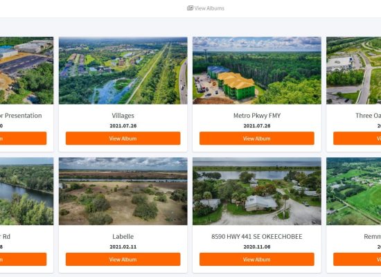
the ProDrones Hub
All of your jobs in one central location.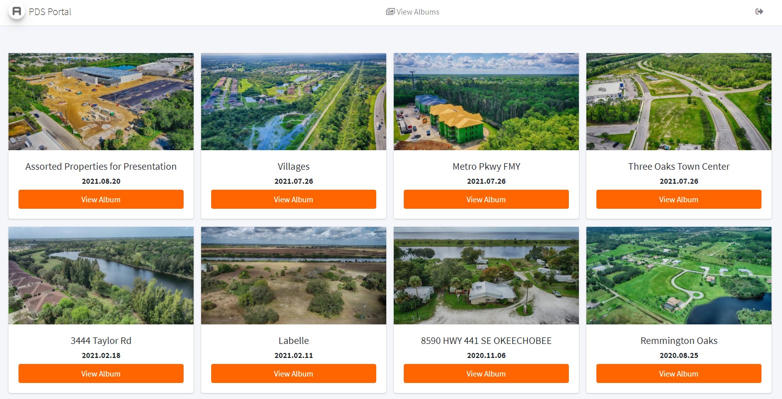
At Professional Drone Solutions, we are passionate about easy to access, easy to use data. When our clients trust us to document their long term projects, we make it easy for them to find their data. We built our progress photography management solution “The HUB” to take guesswork out of finding historical photos.
Our clients use this software to easily track progress on jobs and to locate old photos to show before-and-afters to clients.
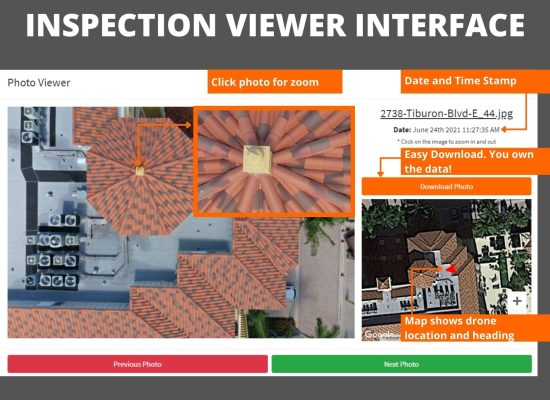
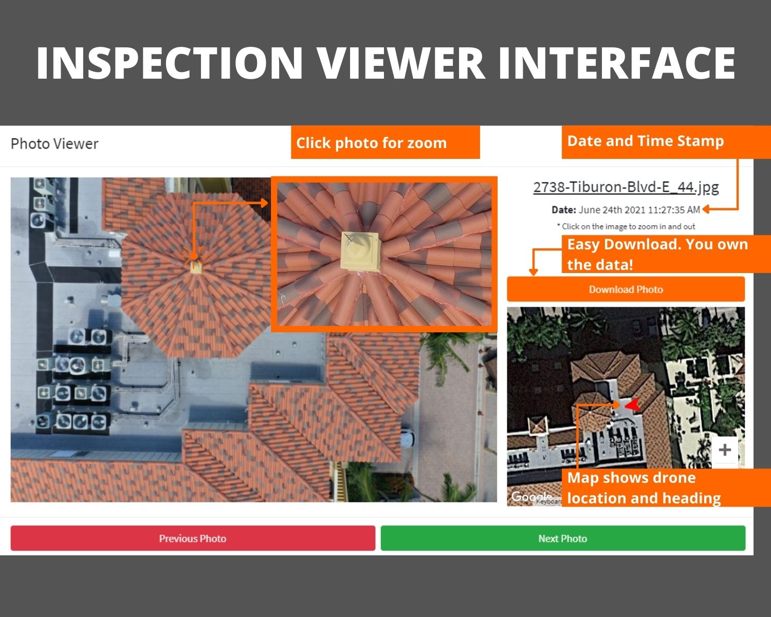
Inspection Viewer
Find context in the cracks. If you are still asking: where is the issue? This is the answer you need.Our Inspection Viewer Solution was borne from the immense amount of data our company gathered after Irma. Our largest customer received 36,000 images of buildings that had been hit hard by the storms 180+ mph winds.
It took our client over 6 months to process the photos and determine if the properties warranted an insurance claim. Our goal with our Inspection Viewer solution was to add as much context to the building inspection process as possible.
With Inspection Viewer 2.0 now running, we are able to offer notation tools, one-click report generation, and our Vertical Viewer module for high rises and vertical assets.
Vertical Viewer allows users to segment projects based on altitude and time, ensuring a easily usable amount of data is shown without loosing any of the context.
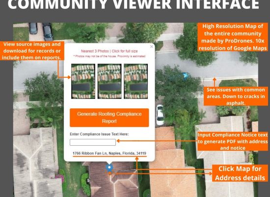
Community Viewer
Compliance, Common areas, and Context.
Since our founding, our company has worked with dozens of HOAs and Property Management firms in traditional drone capacities. We have produced videos, inspected buildings and roofs, we have even completed surveys of golf courses for our HOA clients.
One persistent issue has always presented itself. Centralized and automated documentation for compliance, insurance, and contractor accountability.
With our Community Viewer Solution, we bridge the data gap to provide easy to understand drone scanning and mapping services that help communities in four major ways.
- Centralized and Fair Compliance – our reports make it easy to see what homes are in compliance. Because all homes are recorded and stored, it is fair and equitable. Its also more conducive of privacy than having compliance officers walk other peoples properties.
- Insurance Conditions – our software allows communities to document the condition of properties to reduce disputes during insurance claims.
- Contractor accountability – from roofers to landscapers, sometimes a project doesn’t go as planned. Our software documents the conditions of a community to show what changed… or what didn’t.
- Data retention – Property management has high turnover. This can lead to difficulty retaining or finding data a recently departed employee was in charge of. With our software, the data is held and you always know who to call to find it.
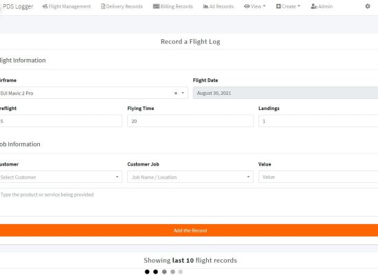
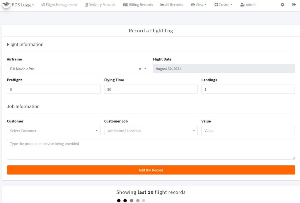
Prodrones flight and job logs
We automate our processes so you get your information quicker.Our flight logging software allows our teams to have enhanced communication with each other and our clients as well as track flight times on our airframes. Our newest version allows real time weather updates, scheduling, and airspace notification. This ensures when our clients hire us, they are getting the most professional team there is!
Craving More Info? Read our blog.

Discover the World of FPV Drone Videos
Introducing FPV Drone Videos: Experience a New Perspective FPV Drone...
Read More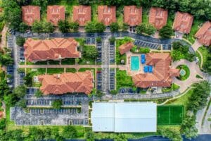
Exploring Drone Altitude Limits: 400 ft Rule
Understanding the 400-Foot Rule: How High Can You Fly Your...
Read More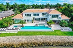
Accelerate Sales with Drone Videos
Selling Properties Faster with Drone Videography In today’s competitive real...
Read More