Win the bid
Premium aerial before-and-after sets and scope maps that make a proposal look like the crew already showed up. The kind of visual a property manager remembers.

LANDSCAPING & GROUNDS CARE
Premium before-and-after sets, scope maps, and dated aerial records that make your proposals stand out and back up every invoice. Your imagery, that you control.
The problem
Landscaping is bid, billed, and disputed on work nobody sees all at once. A ground-level photo shows one bed. An aerial before-and-after shows the whole property changing, so you win the pitch and settle the we-did-do-that conversation with a picture instead of an argument.
What you get
Premium aerial before-and-after sets and scope maps that make a proposal look like the crew already showed up. The kind of visual a property manager remembers.
A dated aerial record of every visit, kept in your name, so an invoice question ends with a link instead of a site visit.
Measure beds, turf, and tree counts from the air to price a property in minutes and plan crew routes before the truck rolls.
Seasonal aerial imagery you hand the client as a value-add, so renewal season starts with proof of a year of good work.
The proof
One pass captures everything you need to prove, plan, or sell. Hover the points to see what we pull from a single flight.

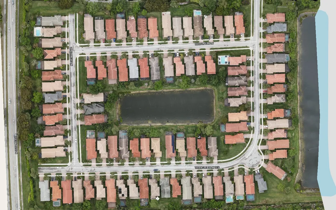
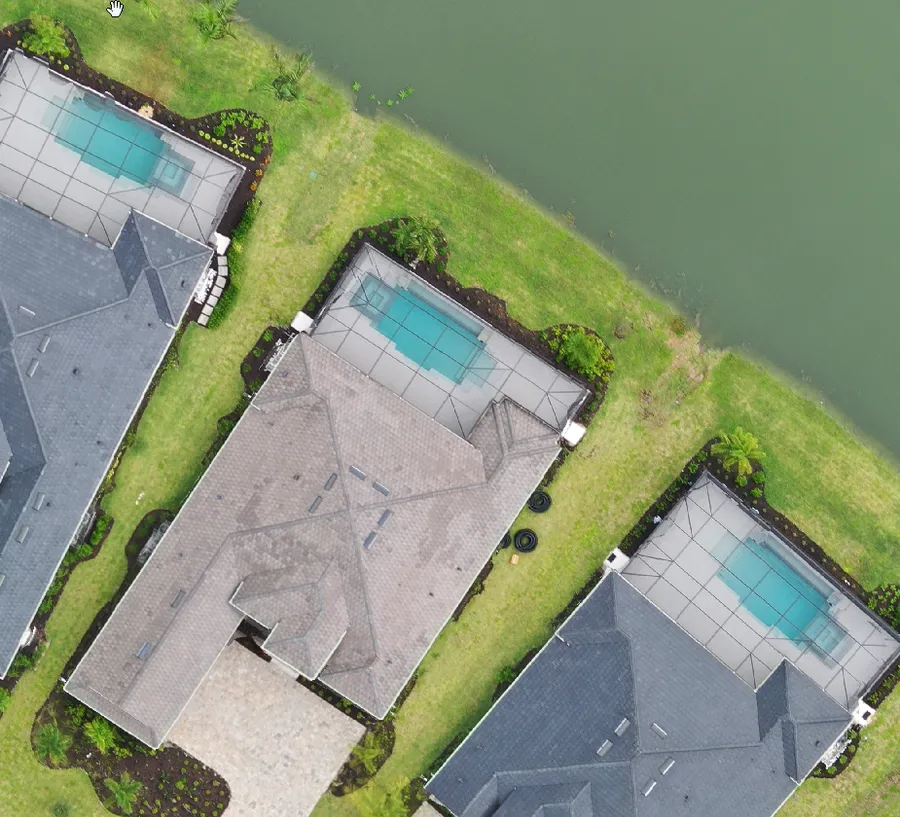
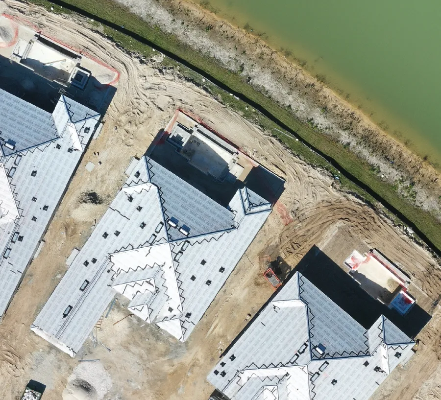
A proposal with a clean aerial before-and-after reads like the crew already showed up. Property managers remember the bid that showed them the whole property at once, beds, turf, tree lines, and entry drives in one frame, next to a rendering of how it will look after your team takes over. Pair that with a branded scope map and your quote stops competing on price alone.
Most invoice questions come down to one thing: did the visit happen and what got done. A dated aerial record of each service answers it in a link. Instead of sending a foreman back out to photograph a finished bed, you send the client the flight from that day. The conversation ends there, and your crew stays on the next job.
You can measure beds, turf areas, and tree counts straight from an aerial pass, so a new property gets priced in minutes rather than a walk-around. The same imagery lets you plan crew routes, stage equipment, and spot access issues before the truck rolls, which keeps your bids tight and your days on schedule.
Renewal season goes easier when you open with proof. Hand the client a season of aerial imagery that shows the grounds improving flight over flight, and the value of your contract is on the screen. It is a simple value-add that turns a maintenance vendor into the partner they keep.
Ready to put aerial imagery to work on your next bid? Tell us about your properties and we will send examples and a quote.
You own the flights we shoot for you. Use the before-and-after in a proposal, drop a scope map into a bid, or keep a dated record of every visit for your files. When you want to show a property manager the whole season at once, the Landscape Viewer puts every flight side by side so a year of work reads in one screen. We also handle aerial photography and site documentation on the same visit.
The Landscape Viewer
Every flight we make lands in the Landscape Viewer, a private web page built for your community. There is no app to install. Open the link, pick a date, and the whole property loads from above as one sharp aerial map. Board members, the manager and the landscaper all look at the same dated record, so questions about the grounds get answered with a link instead of a site walk.
Each visit is saved by date. Pick a flight from the menu and the whole community loads as one stitched aerial map, sharp enough to count palms.
Drag the slider between two dates to see what changed: new sod, a dead palm, lake bank erosion, storm damage.
Drop a pin and add a note. It stays on the map for the board, the manager and the landscaper.
One click turns every note into a branded PDF. Share the link with the board, or download the original files. You own the data.
Start here
The deliverable
Every job ships with an interactive Viewer — the part you cannot get anywhere else — plus the raw files.
See the Viewer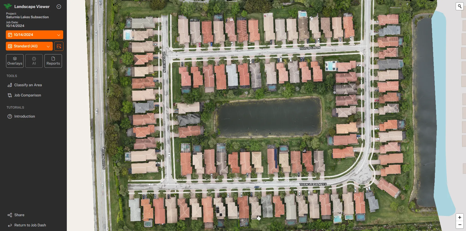
Questions