
Services
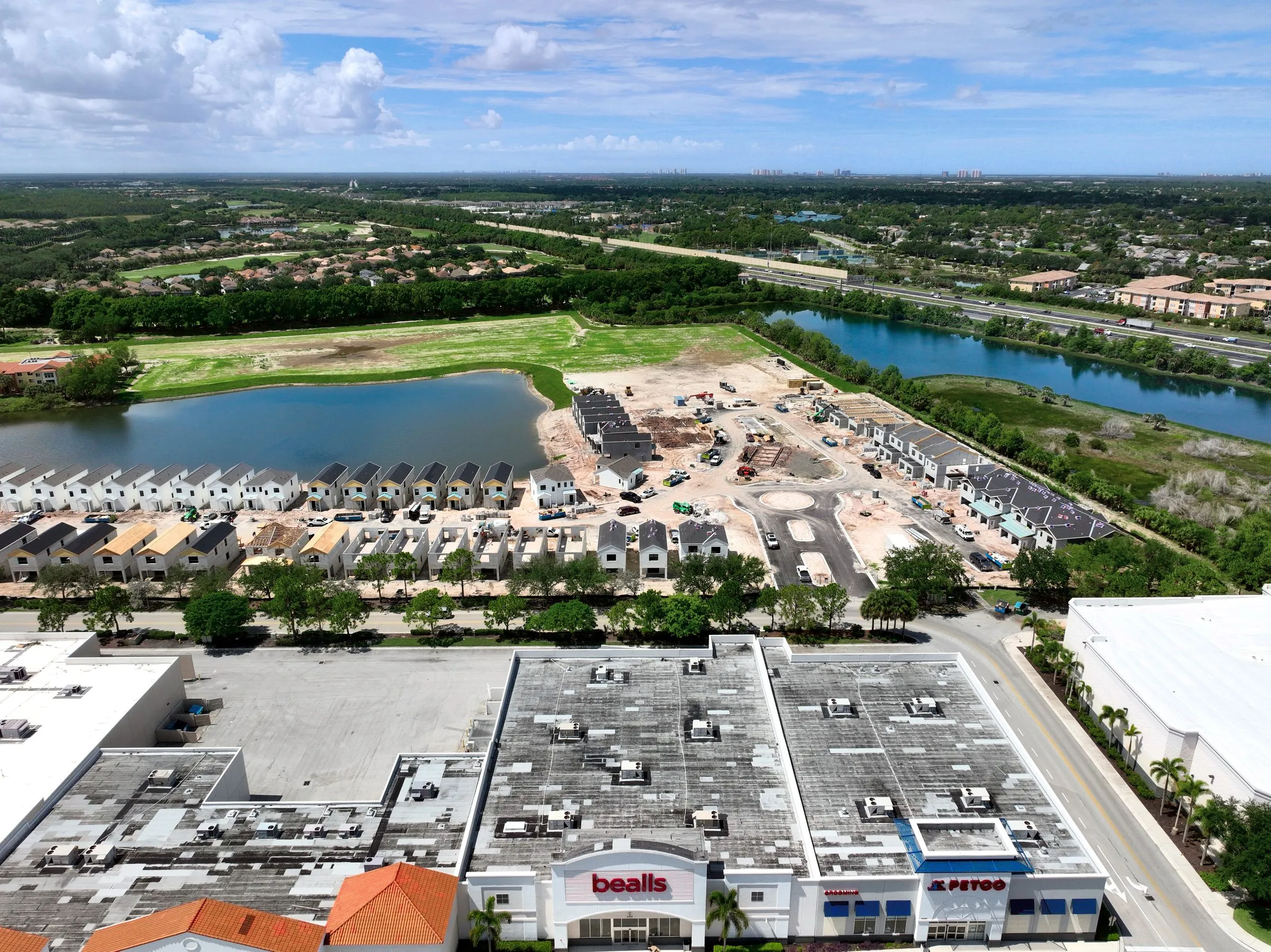
Construction progress photos you open in one link at the owner meeting.
Dated, branded aerial photos on schedule, so your owner meetings start with one link instead of a folder.
- DatedEvery set timestamped and branded
- Same weekFast delivery after flight
- Construct ViewerTimeline when you need the map
What you get
Deliverables
Dated, branded progress photos
Every set carries the date and your banner, ready to drop into an owner update or a lender report.
Fast turnaround on a schedule
Weekly, monthly, or milestone cadence, delivered quickly so the photos are still current when you present them.
Aerial maps when you need them
When a true top-down site map is warranted, we build the complete aerial view in-house from around 400 images.
Construct Viewer timeline
The aerial map lives in Construct Viewer as a dated, side-by-side timeline the whole team logs into.
How it works
The process
Set the cadence
Weekly, monthly, or tied to milestones. We fly the same paths each visit so the photos compare cleanly over time.
Capture the site
Certified pilots shoot the dated, branded progress imagery, fast.
Deliver same week
Photos land quickly so they are current for the owner meeting, not a month stale.
Upgrade to the record
When you need the full map, we build the complete aerial view and it becomes a dated timeline in Construct Viewer, one link for the owner.
Proof
The numbers
- Every set timestamped and branded
- Dated
- Fast delivery after flight
- Same week
- Timeline when you need the map
- Construct Viewer
How we compare
What you get with PDS.
Every row is a real deliverable. Check what matters to your project.
| What you get | PDS | Ad-hoc drone service | Freelance / no system |
|---|---|---|---|
| Fixed schedule reliability | Weekly or monthly cadence | On-demand only | Unreliable |
| Dated, branded photo sets | Yes | Sometimes | Not available |
| Construct Viewer timeline | Included | Not available | Not available |
| Same-angle repeat shots | Every flight | Rarely | Not available |
| Same-week delivery | Yes | 1-2 weeks | Varies |
| Cloud archive + stakeholder links | Yes | Not available | Not available |
Capabilities reflect typical offerings; confirm specifics with each provider.
Photos first, the record when you need it
No one wants a folder of photos. An owner meeting opens with one link that shows exactly where the job is, and the whole team checks that link instead of driving out just to see where things stand. So we lead with fast, dated, branded progress imagery on a cadence, and we do not pretend every set is a complete aerial view. Progress photos and aerial maps are different products. One avoided survey trip or one settled subcontractor dispute usually covers a month of progress documentation.
When the aerial map earns its cost
A true site map is stitched from around 400 images and can be constrained by airspace. When one is warranted, we build it in-house and it lives in Construct Viewer as a dated, side-by-side timeline. That jump, from photos to a record the whole team logs into, is what settles subcontractor disputes and keeps owners and lenders looking at the same reality.
Most of this work serves construction and land development teams.
The deliverable
One flight becomes a living model.
Every job ships with an interactive Viewer — the part you cannot get anywhere else — plus the raw files.
See the Viewer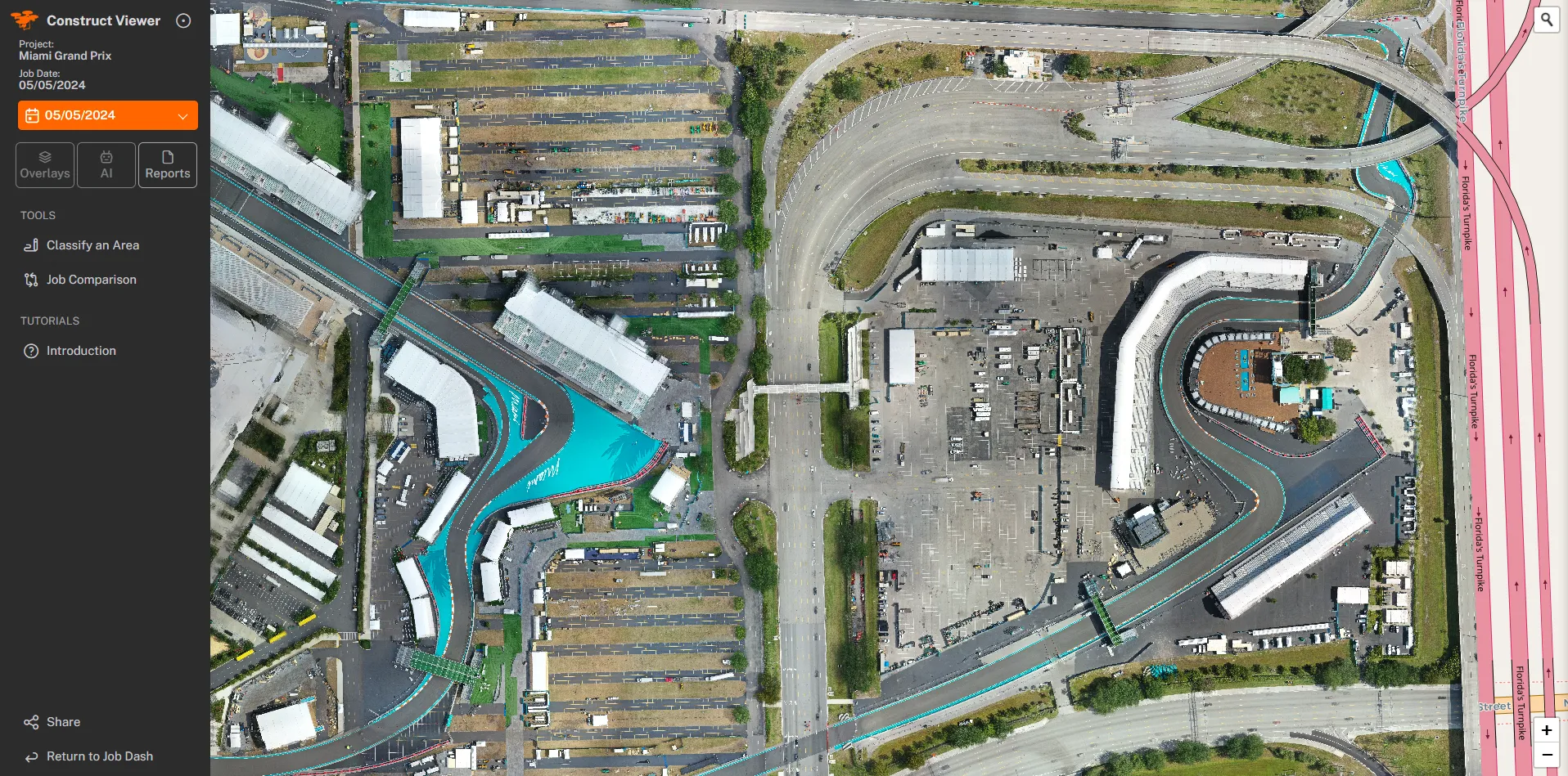
Questions