
Services
One drone program for every site you own, anywhere in the country.
One contract, one spec, and one point of contact. Every site is shot to the PDS standard and delivered in the same Viewers with the same branding and dates.
- One specEvery site shot the same way
- One invoiceSingle contract and report
- Part 107Vetted, insured operators
What you get
Deliverables
One contract, one point of contact
A single agreement and a single PDS contact cover every site in the program, whatever state it is in.
Vetted, insured Part 107 operators
Every operator is FAA Part 107 certified, insured, and held to the PDS shot list for the job.
A defined shot list per site type
We write the spec once for your asset type, so a tower in one market and a tower in another are captured the same way.
QA and in-house editing
Every upload is checked against the spec, then graded and cut by our in-house editors so the whole portfolio looks like one set.
Delivery in the PDS Viewers
Imagery, maps, and records land in the same Viewers your team already uses, with dated, branded records for every visit.
One invoice and one report
A single invoice and a single program report replace a stack of vendor bills and a folder of mismatched files.
How it works
The process
Write the spec
We agree the sites, the asset types, the shot list, and the cadence. The spec becomes the standard every flight is held to.
Assign and brief operators
We place vetted, insured Part 107 operators at each site and brief them on the shot list before they fly.
Review every delivery
Each upload is checked against the spec. Anything off gets re-shot before it reaches you.
Edit and deliver in the Viewers
Our in-house editors finish the media, and everything is published to the PDS Viewers as dated, branded records.
Report and invoice once
You get one program report and one invoice for the period, across every site.
Proof
The numbers
- Every site shot the same way
- One spec
- Single contract and report
- One invoice
- Vetted, insured operators
- Part 107
One standard across every site
A company with fifty properties usually ends up with fifty different drone results. Each local vendor shoots what they think you want, names files their own way, and delivers on their own schedule. By the time it reaches headquarters, nothing lines up and nothing compares.
Nationwide Drone Program Management replaces that with one contract, one spec, and one point of contact at PDS. We manage the operators who fly your sites so they shoot to the PDS shot list, and we deliver through our own technology: the PDS Viewers, in-house editing, and branded, dated deliverables. The result is a consistent product anywhere in the country, and abroad when the work calls for it.
What you get
Vetted, insured operators. Every operator is FAA Part 107 certified and insured, and is briefed on your shot list before the first flight. You do not need to find, qualify, or supervise pilots in each market.
A spec that travels. We write the shot list once for each asset type, whether that is a jobsite, a hotel, a roof, or a retail center. The same angles, altitudes, and coverage apply at every location, so images from different states sit side by side.
QA before delivery. Every upload is checked against the spec. If a site is missing a shot or the light is wrong, it is re-flown before it reaches you.
In-house editing. Our editors grade and cut everything in one place. The look, the branding, and the dating are the same whether the footage came from Naples or a site two time zones away.
Delivery in the Viewers. Imagery and records are published in the PDS Viewers as dated, branded records. Your team opens one link per site and can compare visits over time, instead of digging through shared drives.
One invoice and one report. A single invoice and a single program report cover every site. Finance sees one line, and operations sees one status view.
Who it is for
This program is built for organizations with many sites and one standard to hold:
- Builders and general contractors documenting progress across many jobsites.
- Land developers tracking several communities at once.
- Commercial real estate owners, REITs, and property portfolios that need matching media for every asset.
- Hospitality brands that want every property to look like part of the same family.
- Insurers and roofing teams that need inspections documented the same way in every market.
- Retail and industrial portfolios with large numbers of similar sites.
Where survey-grade mapping fits
Survey-grade mapping stays in Florida, delivered by our sister company FAST under its own license. Outside Florida, the program covers aerial media, inspections, and progress documentation. See survey and mapping for the Florida scope.
Start with the footprint
Send us the list of sites, the asset types, and how often you want them flown. We will come back with a spec, a cadence, and one price. You can also see how single-market work runs on our aerial video and photography and progress documentation pages.
The deliverable
One flight becomes a living model.
Every job ships with an interactive Viewer — the part you cannot get anywhere else — plus the raw files.
See the Viewer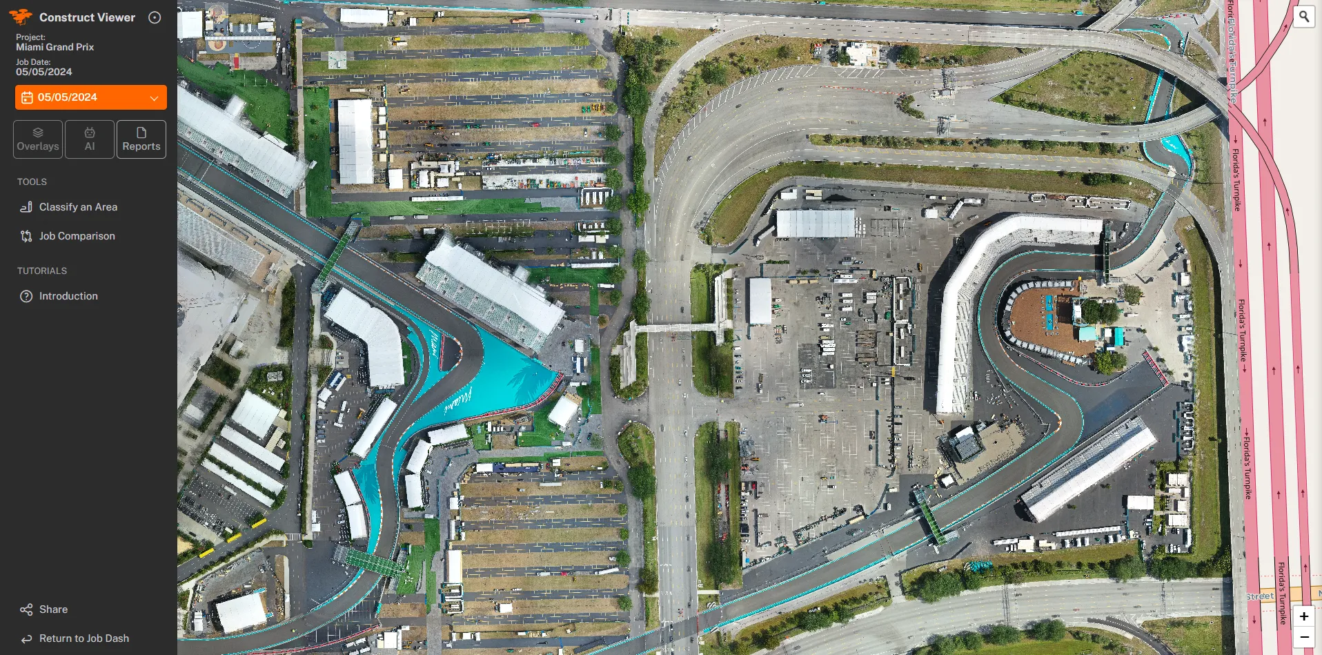
Questions