Cost & Pricing
10 Jobs a Drone Does Better Than the Old Way, and Why
Roof checks, high-rise facades, progress records, storm claims and more. What each job used to take, and what a drone changes in time, safety and proof.
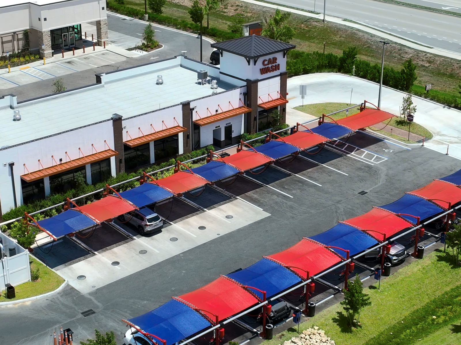
Most lists of commercial drone uses make drones sound like cool cameras. For the people who hire us, they matter for duller reasons: nobody climbs the roof, the lift never gets rented, and the photos come back dated and located, so the record settles arguments later. Here are ten jobs where that adds up, what each one used to take, and what changes when the camera is in the air.
Key takeaways
- The biggest wins are safety and time: no climbing, no lifts, no closing the site.
- A drone flight leaves a dated, located record, which is what settles disputes and claims.
- Repeat flights from the same angles turn photos into proof of change over time.
- Every job here is commercial and needs a licensed Part 107 pilot.
Commercial drone uses at a glance
| Job | The old way | What a drone changes |
|---|---|---|
| Roof inspection | Ladder and a walk on the roof | Every slope in one visit, nobody on the roof |
| High-rise facade | Swing stage or rope access | Full elevation passes in hours, no rigging |
| Thermal moisture scan | Cut test holes, guess the spread | A heat map of the whole roof |
| Construction progress | Phone photos from the ground | Same angles every flight, dated and branded |
| Storm baseline and claims | Adjuster walk after the damage | Proof of condition from before the storm |
| Stockpile volumes | Walk the pile with a GPS rover | Measure every pile without climbing one |
| Site survey | Weeks of field crew time | Engineer-grade data from a mapped flight |
| Real estate and CRE | Ground photos of the front | Location, access and context buyers ask about |
| HOA and landscaping | Drive the property and take notes | Compare every common area flight to flight |
| Events and brand film | Crane or helicopter | Moving aerial shots on a ground crew budget |
1. Roof inspection
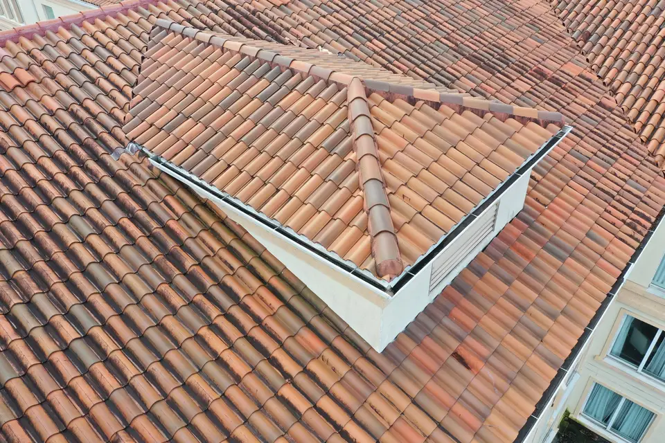
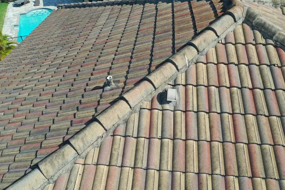
The old way: someone sets a ladder and walks the roof. On a tile roof, every step risks cracking the tiles you are there to inspect. On a steep or wet roof, it is a fall risk, and parts of it never get looked at.
With a drone: every slope, valley, flashing and penetration gets photographed in one visit, close enough to read individual tiles. In 2017, after Hurricane Irma, that let us inspect 250 roofs in two weeks, a pace no crew on ladders could match.
Who buys it: property managers, HOAs, roofers quoting replacements, and insurers. See drone roof inspections or what one costs in Florida.
2. High-rise facade and balcony checks
The old way: swing stages or rope access teams, rigged from the roof and moved drop by drop. That means days per elevation, roof access, and residents living next to a crew outside their windows.
With a drone: the pilot flies each elevation in passes, and a licensed pilot can fly up to 400 feet above the top of a tall building while staying near it (how that rule works). You get every balcony edge, sealant joint and window line on record, so the rope team only goes where the photos show a problem.
Who buys it: condo associations, engineers doing milestone inspections, and building managers. More in why drones beat the cherry picker.
3. Thermal moisture scans
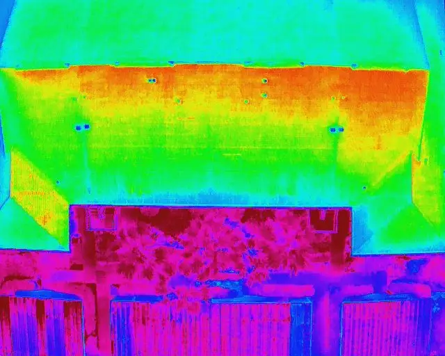
The old way: a leak shows up inside, and someone cuts test cores in the roof to see how far the water spread. Each core is a guess and a new hole to patch.
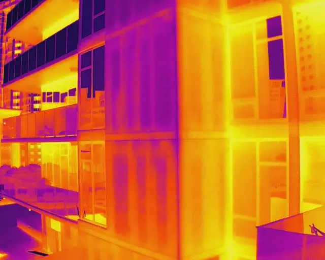
With a drone: a thermal camera shows the heat pattern across the whole roof. Wet insulation holds heat differently from dry, so the wet area shows up as a shape you can measure and repair, instead of a guess.
4. Construction progress records
The old way: the superintendent takes phone photos from the ground. They are hard to compare, nobody knows which week they are from, and they never show the whole site.
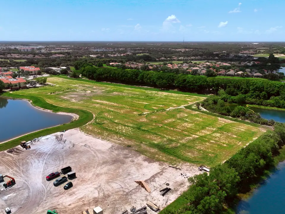
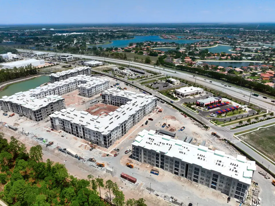
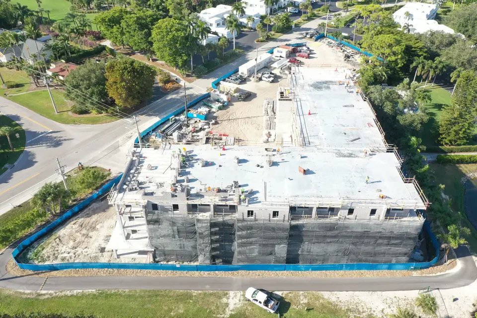
With a drone: the same angles every flight, each image dated and branded, so the owner sees exactly what changed since last time. When a schedule question or a change order dispute comes up, the record already exists. See progress documentation.
5. Storm baseline and insurance claims
The old way: after a hurricane, the owner and the adjuster argue about what was already wrong with the roof. Without proof of the “before,” the owner loses that argument.
With a drone: a flight before storm season records the condition of every roof and building. After the storm, a second flight from the same angles shows exactly what changed. Drag the slider to see one Southwest Florida street before and after Hurricane Ian.
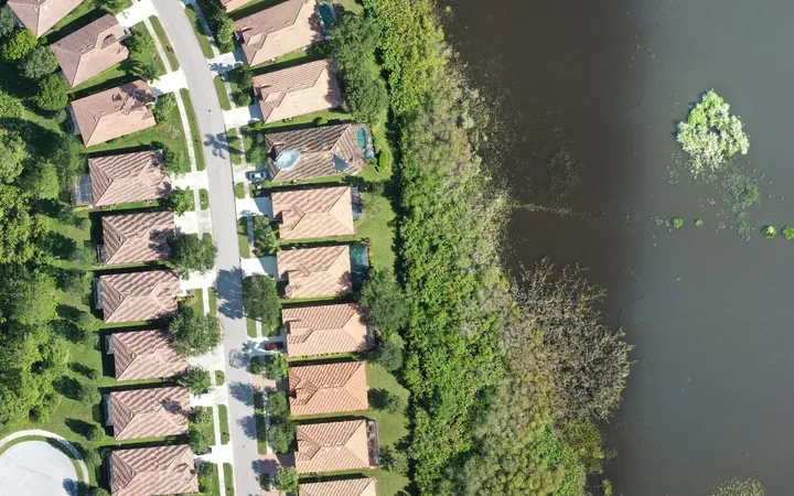
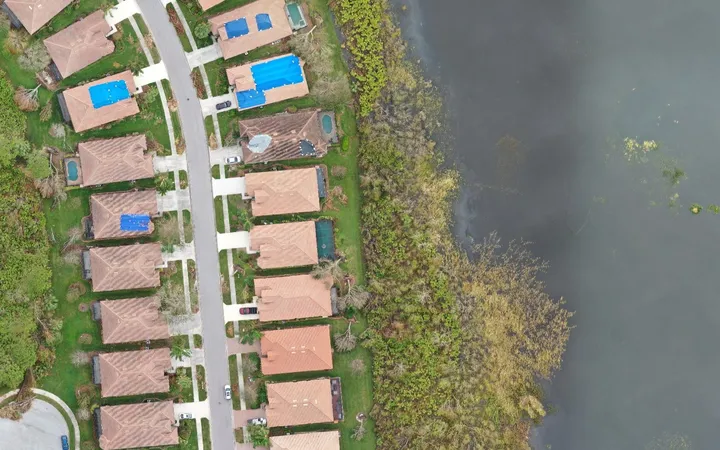
More on why a pre-hurricane baseline protects your claim.
6. Stockpile volumes
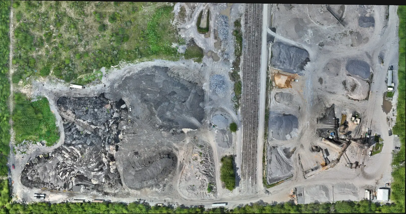
The old way: a surveyor walks each pile with a GPS rover, climbing loose material near running equipment. Big yards take days, so counts happen less often than they should.
With a drone: one mapped flight measures every pile in the yard, and nobody climbs anything. Volumes are produced by our sister company, Florida Aerial Survey Technologies (FAST), a licensed survey business.
7. Site survey and mapping
The old way: a field crew spends days or weeks collecting points across a site, and every return trip to fill a gap costs more.
With a drone: a mapped flight captures the whole site at once, with survey control on the ground, and engineers get topography and site data they can design from. Survey work runs under FAST’s license. Compare the two in drone survey vs. traditional survey.
8. Real estate and commercial listings
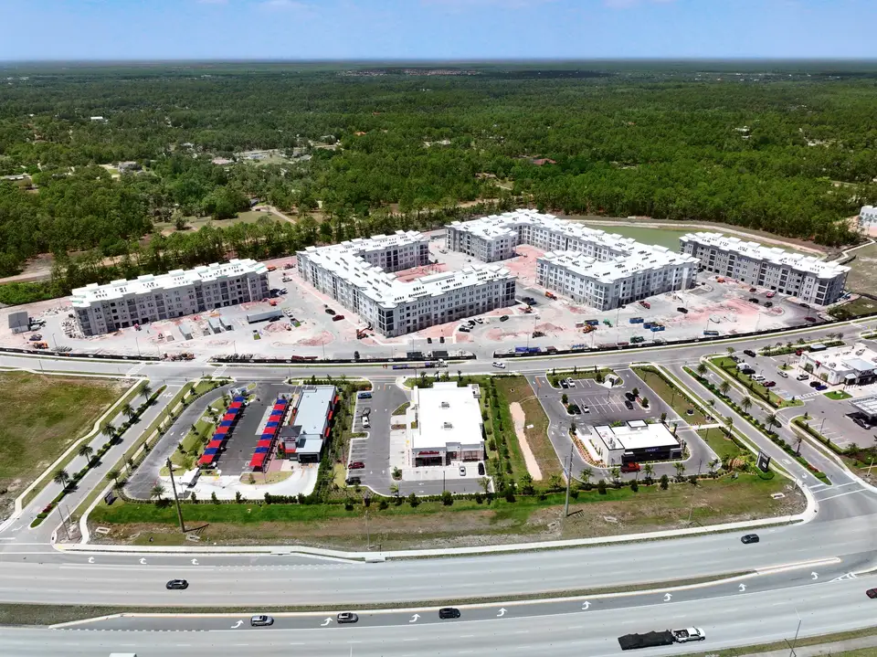
The old way: photos of the front of the building from the parking lot. Buyers still have to drive out to learn what is next door, where the road access is, and how close the water is.
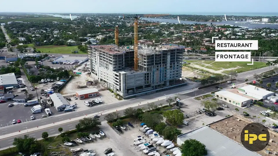
With a drone: aerials answer those questions before the first call. For commercial property, labeled callouts show frontage, access points and nearby anchors. See aerial video and photography and commercial real estate.
9. HOA common areas and landscaping
The old way: a board member drives the property and takes notes. On a large community, whole sections go unchecked, and nobody can prove whether the landscaping got better or worse since last month.
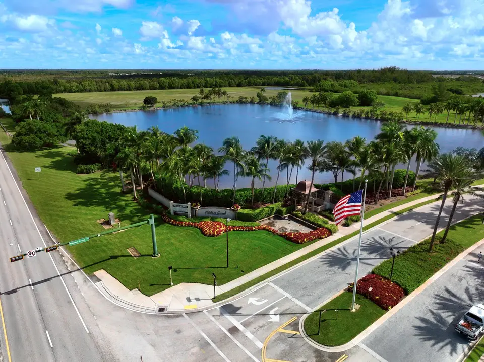
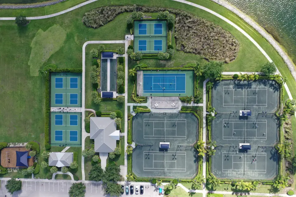
With a drone: regular flights over every common area, compared side by side. A dry patch, a dead hedge row or a washed-out bank shows up while it is still a small fix. See HOA communities and the Landscape Viewer.
10. Events and brand film
The old way: a camera crane on the ground or a helicopter in the air. One is limited in height and movement, the other is expensive and loud.
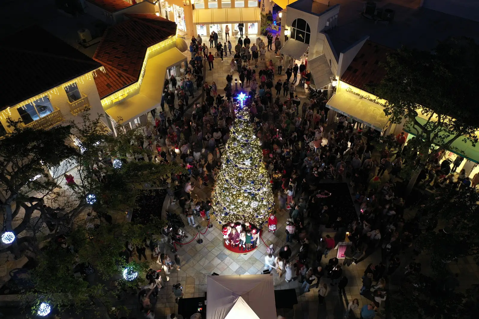
With a drone: smooth moving shots over a venue, a crowd or a waterfront, edited in-house into a finished film. Read what FPV drone video adds.
What all ten have in common
Each flight is planned by a licensed pilot, flown legally for the airspace, and delivered as a dated, located record you can use later. That record is the real product. A roof photo from March is worth a lot more in October when someone asks what the roof looked like before the storm.
What is the most common commercial use for a drone?
Does a drone cost less than the old way?
Do these jobs need a licensed pilot?
Can a drone see inside a building?
Have one of these jobs coming up? Get a quote.
Request a quote